Log in
All resources
Create a design
274 Free Artworks of Maps Of Ireland
1685 maps
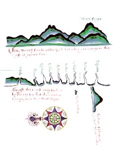
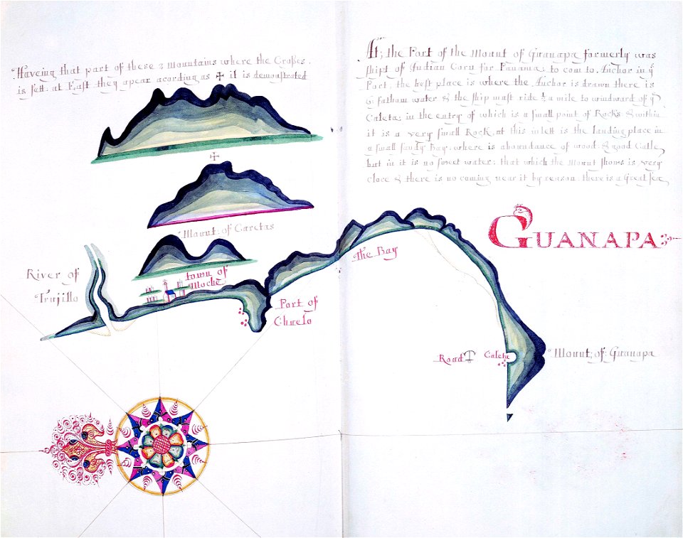
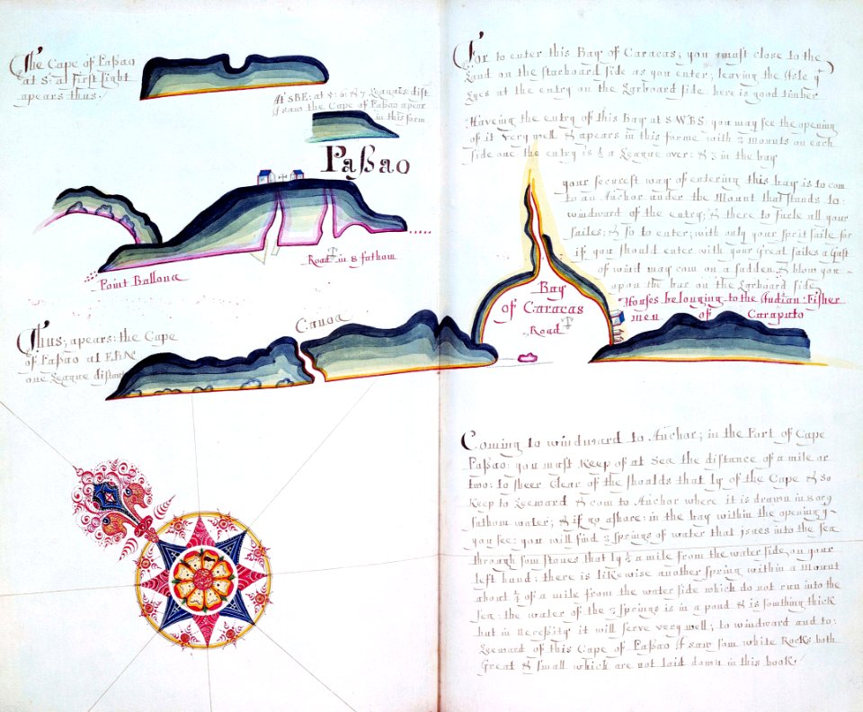
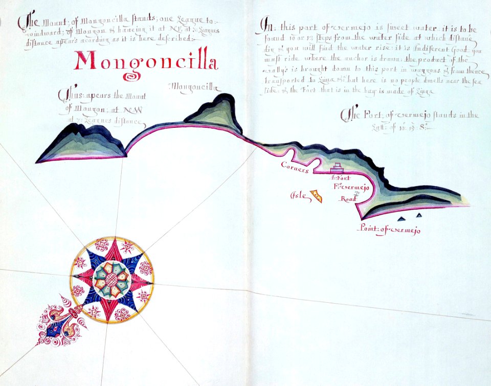
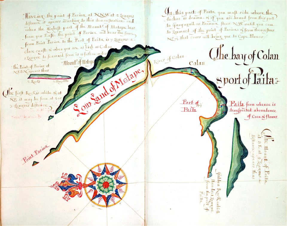
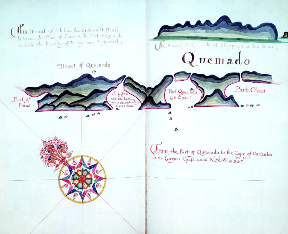
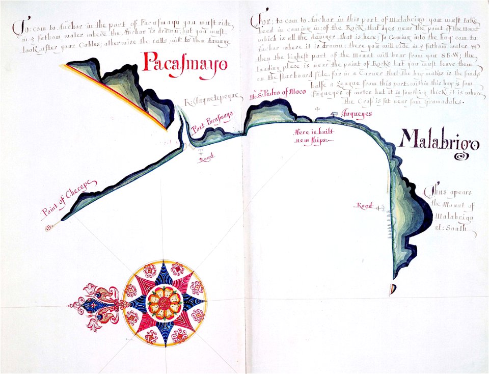
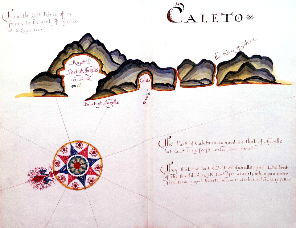
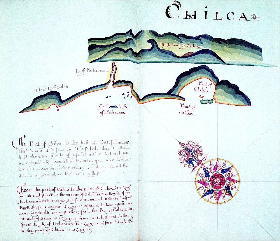
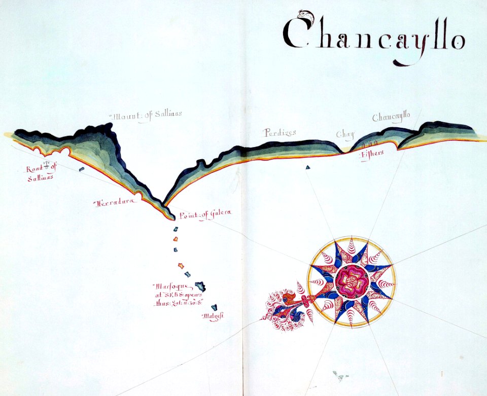
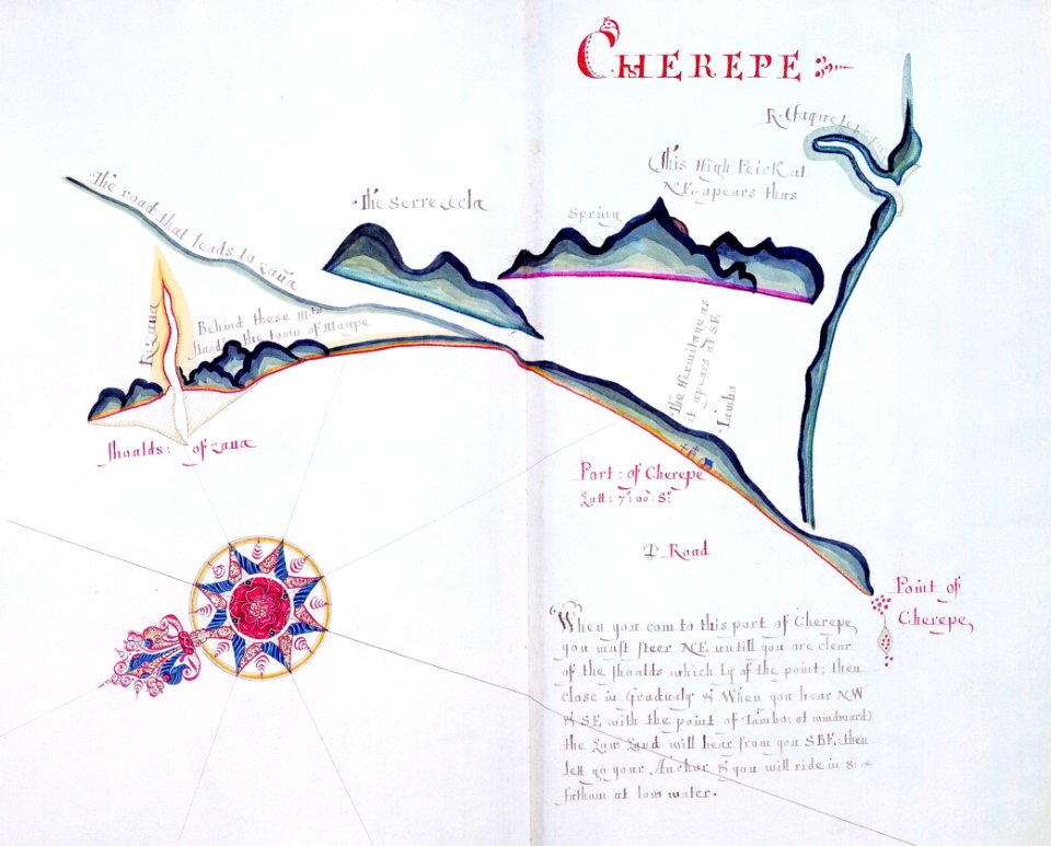
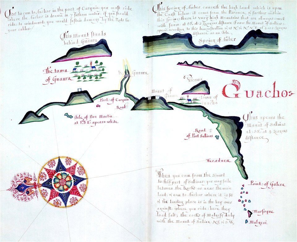
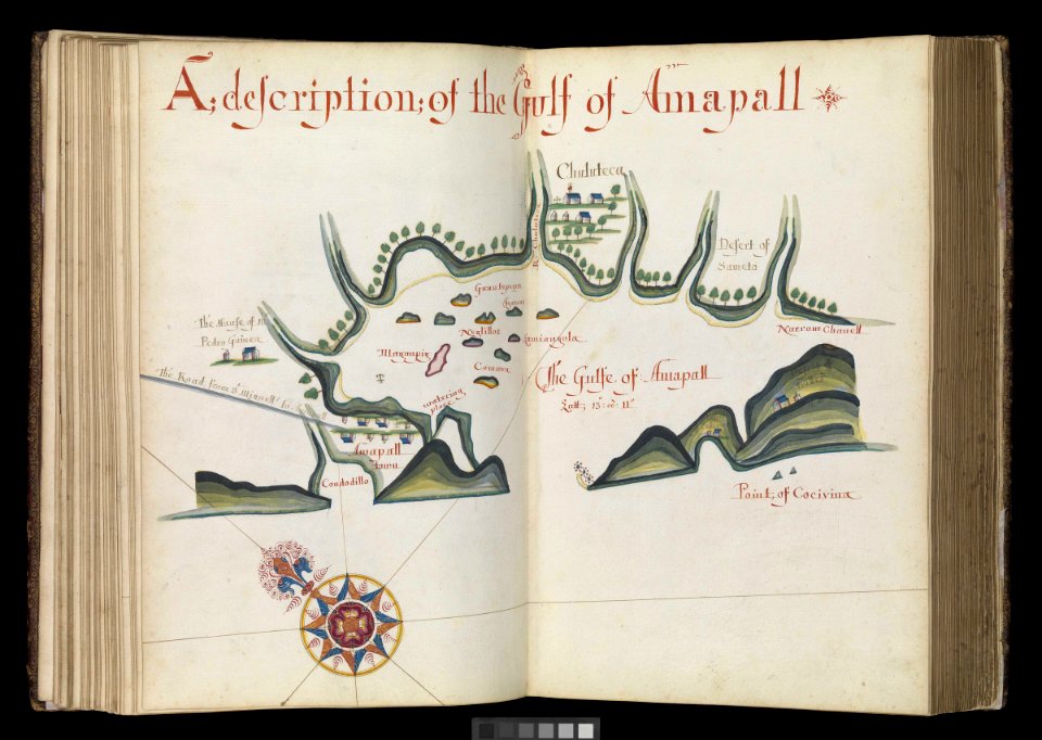
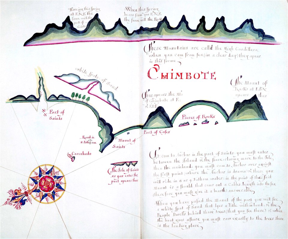
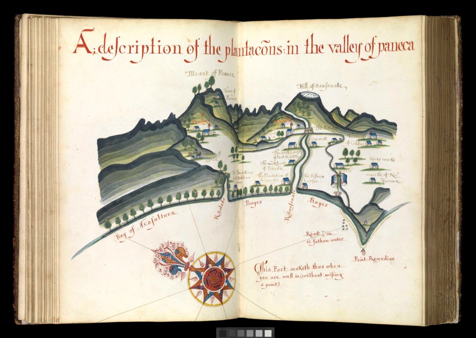
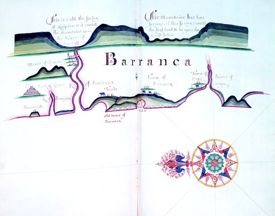
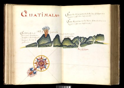
a waggoner of the south sea describing the sea coast from acapulco to albermarle isle
made by william hack at the signe of great britaine and ireland in wapping. anno 1685 (rmg)
copper engraving print
1667 maps
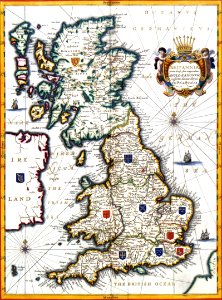
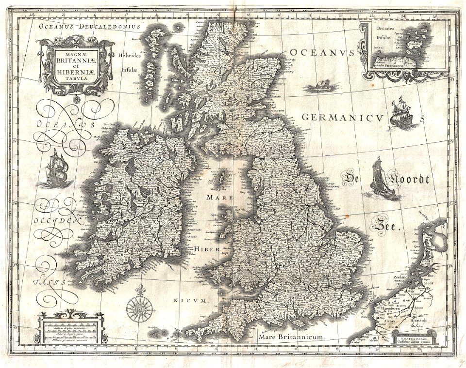
atlas maior, vol 6 (scotland and ireland) - joan blaeu, 1667 - bl 114.h(star).6
joan blaeu
british library
miniature speed atlas (1627) pieter van den keere
pieter van den keere
a waggoner of the south sea describing the sea coast from acapulco to albermarle isle
1685 maps
a waggoner of the south sea describing the sea coast from acapulco to albermarle isle
1685 maps
a waggoner of the south sea describing the sea coast from acapulco to albermarle isle
1685 maps
a waggoner of the south sea describing the sea coast from acapulco to albermarle isle
1685 maps
a waggoner of the south sea describing the sea coast from acapulco to albermarle isle
1685 maps
a waggoner of the south sea describing the sea coast from acapulco to albermarle isle
1685 maps
a waggoner of the south sea describing the sea coast from acapulco to albermarle isle
1685 maps
a waggoner of the south sea describing the sea coast from acapulco to albermarle isle
1685 maps
a waggoner of the south sea describing the sea coast from acapulco to albermarle isle
1685 maps
a waggoner of the south sea describing the sea coast from acapulco to albermarle isle
1685 maps
a waggoner of the south sea describing the sea coast from acapulco to albermarle isle
1685 maps
a waggoner of the south sea describing the sea coast from acapulco to albermarle isle
1685 maps
a waggoner of the south sea describing the sea coast from acapulco to albermarle isle
1685 maps
a waggoner of the south sea describing the sea coast from acapulco to albermarle isle
1685 maps
a waggoner of the south sea describing the sea coast from acapulco to albermarle isle
1685 maps
a waggoner of the south sea describing the sea coast from acapulco to albermarle isle
1685 maps
a waggoner of the south sea describing the sea coast from acapulco to albermarle isle
1685 maps
a waggoner of the south sea describing the sea coast from acapulco to albermarle isle
1685 maps
a waggoner of the south sea describing the sea coast from acapulco to albermarle isle
1685 maps
a waggoner of the south sea describing the sea coast from acapulco to albermarle isle
1685 maps
a waggoner of the south sea describing the sea coast from acapulco to albermarle isle
1685 maps
a waggoner of the south sea describing the sea coast from acapulco to albermarle isle
1685 maps
a waggoner of the south sea describing the sea coast from acapulco to albermarle isle
1685 maps
a waggoner of the south sea describing the sea coast from acapulco to albermarle isle
1685 maps
a waggoner of the south sea describing the sea coast from acapulco to albermarle isle
1685 maps
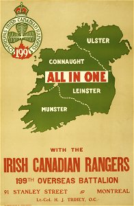
world war i posters in the library of congress
cef
world war i posters in the library of congress
cef
coats of arms of scotland
hatched coats of arms
old maps of the british isles
victorian era
st mary's church
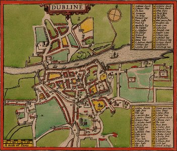
dublin
crowns in art
shamrock
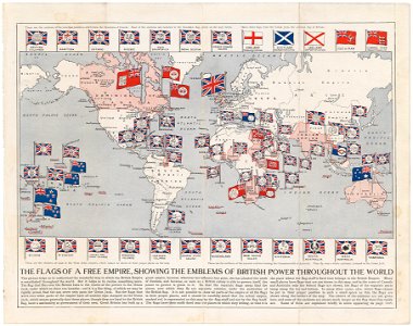
colonial
global
1720s fashion
realism
maps of the history of the united kingdom
maps of voyages
cornell: persuasive cartography: the pj mode collection
1790s maps of england
admiralty charts region b: england wales ireland english channel southern north sea
admiralty charts 1801-2000
admiralty charts region b: england wales ireland english channel southern north sea
admiralty charts 1401-1600
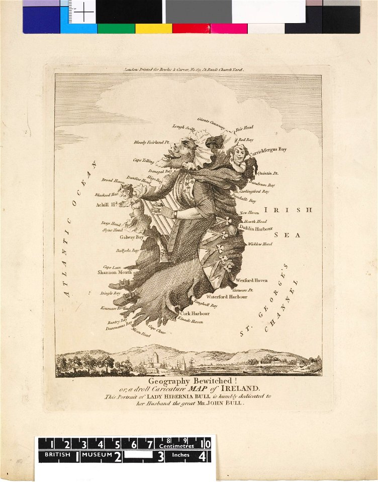
the french invasion of ireland in '98 (1890) by gribayèdoff
maps from the mechanical curator collection
1794 rocque wall map of ireland
county clare
1760s maps of ireland
1766 maps
illustrations from letters from england
maps of ireland
1794 rocque wall map of ireland
graphical scales
17th-century maps of ireland
maps of munster, ireland
maps by nicolaes visscher i
atlas van der hagen
grosser deutscher atlas
1790s maps of ireland
maps by john cary
1799 maps
maps in the british museum
maps of the irish sea
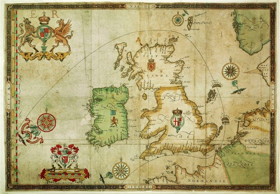
maps of ireland by baptista boazio
maps in the library of congress
maps of ireland by baptista boazio
maps in the library of congress
charts and maps of the royal museums greenwich
1590 maps
17th-century maps of ireland
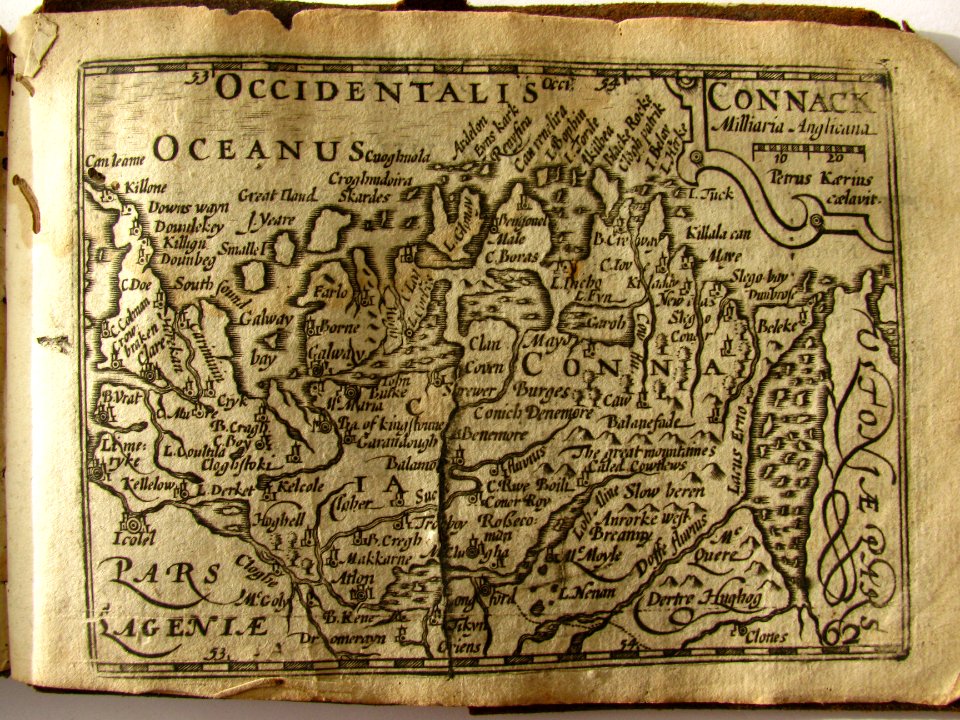
old maps of connaught
eran laor cartographic collection
willem blaeu
atlas vingboons
1665
maps made in the 16th century
maps of the spanish armada
maps in the british museum
1610s maps of ireland
17th-century maps of the british isles
maps by willem and johannes blaeu
atlas maior, vol 6 (scotland and ireland) - joan blaeu, 1667 - bl 114.h(star).6
1667 maps
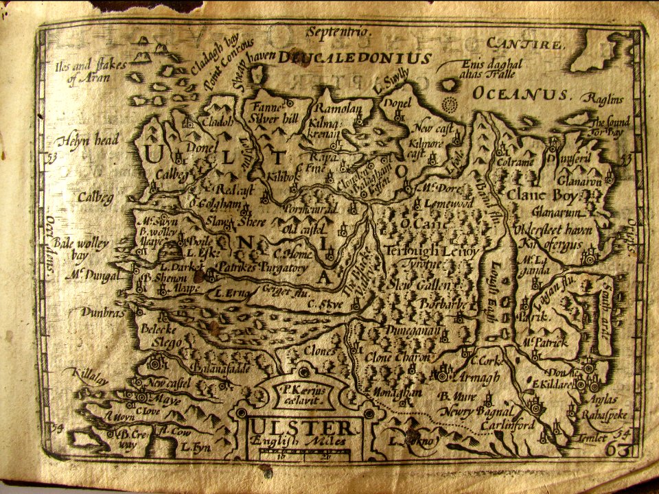
miniature speed atlas (1627) pieter van den keere
maps of ireland by john speed
miniature speed atlas (1627) pieter van den keere
maps of ireland by john speed
miniature speed atlas (1627) pieter van den keere
old maps of the orkney islands
miniature speed atlas (1627) pieter van den keere
old county maps of anglesey
maps from the earth and its inhabitants, vol. iv
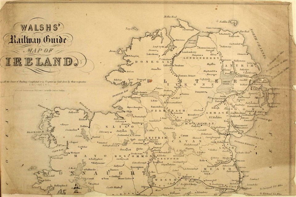
topographic maps of ireland
description de l'universe
1680s maps of ireland
maps of the british isles by gerardus mercator
maps by hendrik hondius the younger
1750s portrait paintings from ireland
thomas hickey
atlas maior, vol 6 (scotland and ireland) - joan blaeu, 1667 - bl 114.h(star).6
1667 maps
satirical prints in the british museum
works after robert dighton
atlas vingboons
1665
satirical prints in the british museum
works after robert dighton
maps from the earth and its inhabitants, vol. iv
turlough
18th-century maps of ireland
old maps of dublin
1640s maps of ireland
baroque
satirical prints in the british museum
works after robert dighton
america
maps
miniature speed atlas (1627) pieter van den keere
county maps of england by john speed
miniature speed atlas (1627) pieter van den keere
old county maps of lincolnshire
admiralty charts region b: england wales ireland english channel southern north sea
admiralty charts 2401-2600
maps in the library of congress
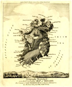
1870 cartoons
maps from the earth and its inhabitants, vol. iv
linguistic maps of ireland
miniature speed atlas (1627) pieter van den keere
old county maps of cheshire
maps of county armagh
1760s maps of ireland
miniature speed atlas (1627) pieter van den keere
old county maps of herefordshire
bibliothèque nationale de france
maps by thomas kitchin
atlas maior, vol 6 (scotland and ireland) - joan blaeu, 1667 - bl 114.h(star).6
1667 maps
description de l'universe
1680s maps of england
miniature speed atlas (1627) pieter van den keere
old county maps of lancashire
miniature speed atlas (1627) pieter van den keere
1620s maps of wales
atlas maior, vol 6 (scotland and ireland) - joan blaeu, 1667 - bl 114.h(star).6
1667 maps
admiralty charts 2601-2800
tralee
maps by willem and johannes blaeu
1640s maps of ireland
keshcarrigan
lough scur
atlas maior, vol 6 (scotland and ireland) - joan blaeu, 1667 - bl 114.h(star).6
1667 maps
atlas maior, vol 6 (scotland and ireland) - joan blaeu, 1667 - bl 114.h(star).6
1667 maps
atlas maior, vol 6 (scotland and ireland) - joan blaeu, 1667 - bl 114.h(star).6
1667 maps
atlas maior, vol 6 (scotland and ireland) - joan blaeu, 1667 - bl 114.h(star).6
1667 maps
atlas maior, vol 6 (scotland and ireland) - joan blaeu, 1667 - bl 114.h(star).6
1667 maps
atlas maior, vol 6 (scotland and ireland) - joan blaeu, 1667 - bl 114.h(star).6
1667 maps
atlas maior, vol 6 (scotland and ireland) - joan blaeu, 1667 - bl 114.h(star).6
1667 maps
atlas maior, vol 6 (scotland and ireland) - joan blaeu, 1667 - bl 114.h(star).6
1667 maps
atlas maior, vol 6 (scotland and ireland) - joan blaeu, 1667 - bl 114.h(star).6
1667 maps
101 - 200 of 274
Next page
/ 3